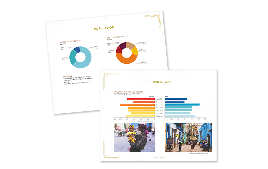
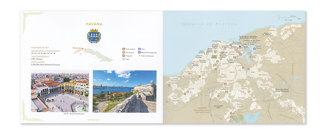
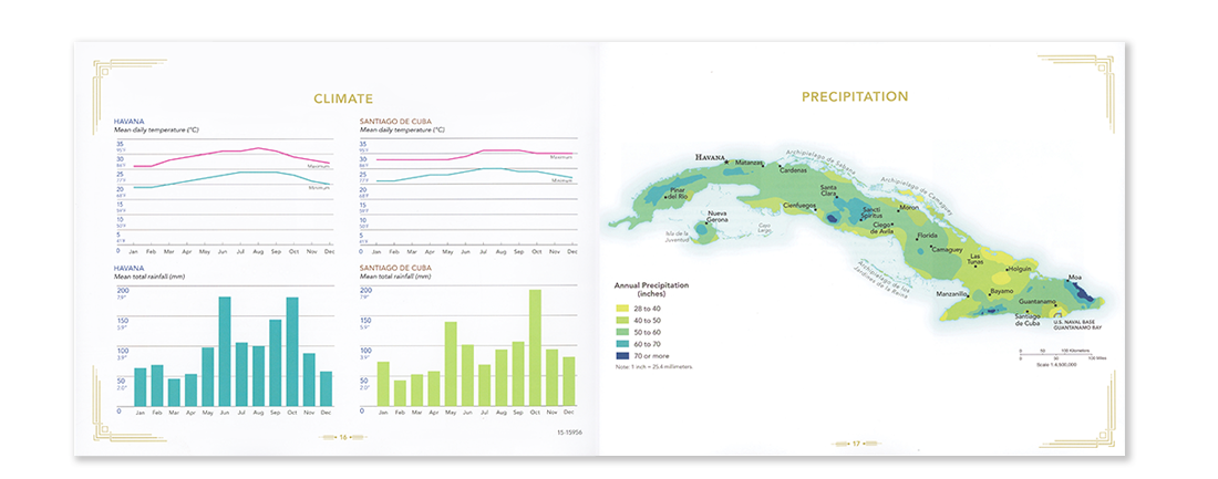
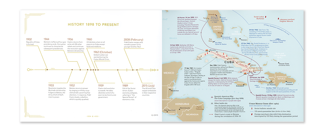
For the US Government’s first map folio of Cuba, we endeavored to bring the story of Cuba’s history, peoples, economy, geography, and climate to life with a combination of smart data visualization, original cartography, and stunning photography.
Inspired by the vibrant colors, classic architecture and unique landscapes of the island, I designed and art directed the map folio. A team of cartographers at the CIA developed all of the original maps.
Copies of the map folio went to the White House, Congress and National Geographic, where it received high praise. Finalist, ICy Award (Interagency Visual Media Excellence Award) 2017.
SKILLS UTILIZED
Art direction
Publication design
Data visualization: charts, graphs and infographics
Collaboration
Project management
Research
Editing